


Minerve au départ de La Caunette

Ada11
User GUIDE
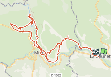

Length
16.8 km

Max alt
354 m

Uphill gradient
522 m
Km-Effort
24 km

Min alt
128 m

Downhill gradient
522 m
Boucle
Yes
Creation date :
2025-04-27 07:02:59.837
Updated on :
2025-04-27 14:18:31.508
7h14
Difficulty : Medium

FREE GPS app for hiking
 SityTrail
IGN / Geographical institutes
SityTrail Plus
The world is yours!
About
Trail Walking of 16.8 km to be discovered at Occitania, Hérault, La Caunette. This trail is proposed by Ada11.
Description
Le temps de trajet comprend 1 heure de pause déjeuner.
Un petit aller-retour face à l'eau.
Un autre par erreur de chemin sur le retour.
Photos


Positioning
Country:
France
Region :
Occitania
Department/Province :
Hérault
Municipality :
La Caunette
Location:
Unknown
Start:(Dec)
Start:(UTM)
482015 ; 4799887 (31T) N.
Comments